Great Chishill on 28 Mar 24

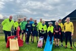
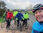
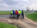
Leaders: Steve, Paul

Riders: Rowland, Simon, RobW, Sarah, Jim, John, Terry, Anne H

Distance: 21.7,44.6 miles

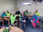
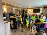
Steve’s group abandoned ride after coffee due to impending storm, but Paul’s group completed the ride!
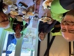
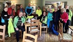
Weather report for 2024-03-28 (between 09:00 and 17:00)
  • Wind speed 21 mph, gusting 37 mph, from the S
  • Temperature average 9°C (8min/10max)
  • Feels like 3°C (2min/4max)
  • Sun 5.6 hours, cloud cover 78%
  • Rain 4.00 mm

Blue

(Download route as gpx file)
  • Total Distance: 21.73 miles
  • Climbing: 674.7 ft
  • Descending: -686.5 ft
  • Max elevation: 260.8
  • Min elevation: 32.5
  • Elapsed: 02:28:14
  • Moving: 01:46:52

Red

(Download route as gpx file)
  • Total Distance: 44.65 miles
  • Climbing: 2593.2 ft
  • Descending: -2596.4 ft
  • Max elevation: 504.5
  • Min elevation: 61.7
  • Elapsed: 06:02:58
  • Moving: 03:39:47

   
Average rating  1 2 3 4 5fYou must login to vote
image0.jpeg
image0.jpeg
image0.jpeg
image0.jpeg
image0.jpeg
image0.jpeg
image0.jpeg
image0.jpeg
image0.jpeg
image0.jpeg
image0.jpeg
image0.jpeg
image0.jpeg
 

240328-rt

240328-ah

Balsham on 21 Mar 24

Leaders: Simon, Sarah

Riders: Rowland, Jim, John, Jean, Derek S, Annie, Alan, RobW, Rob, DerekM, Philip I, Bill, Anne H

Distance: 35.6,41.6 miles

Weather report for 2024-03-21 (between 09:00 and 17:00)
  • Wind speed 10 mph, gusting 20 mph, from the SW
  • Temperature average 12°C (8min/14max)
  • Feels like 9°C (6min/11max)
  • Sun 0.0 hours, cloud cover 92%
  • No rain

Green

(Download route as gpx file)
  • Total Distance: 41.75 miles
  • Climbing: 1294.6 ft
  • Descending: -1294.6 ft
  • Max elevation: 378.5
  • Min elevation: 15.7
  • Elapsed: 05:34:47
  • Moving: 03:27:59

Lightblue

(Download route as gpx file)
  • Total Distance: 35.66 miles
  • Climbing: 1791.5 ft
  • Descending: -1773.8 ft
  • Max elevation: 363.4
  • Min elevation: -11.2
  • Elapsed: 05:07:37
  • Moving: 02:42:24

   
Average rating  1 2 3 4 5fYou must login to vote
image0-2.jpeg
image0-2.jpeg
image0-2.jpeg
image0-2.jpeg
image0-2.jpeg
image0-2.jpeg
image0-2.jpeg
image0-2.jpeg
image0-2.jpeg
image0-2.jpeg
image0-2.jpeg
image0-2.jpeg
image0-2.jpeg
 

240321-rt 240321-ah

Steeple Bumpstead on 14 Mar 24

Leaders: Derek S, Mike G

Riders: Rhona, Rowland, Simon, Jim, Jo, Simon H, Rob, Philip, DerekM, Sarah, Annie, Jean, John, Terry, Ian T, RobWilkinson

Distance: 46,42 miles

Weather report for 2024-03-14 (between 09:00 and 17:00)
  • Wind speed 15 mph, gusting 29 mph, from the S (varying between S and SW)
  • Temperature average 14°C (10min/16max)
  • Feels like 10°C (7min/12max)
  • Sun 3.8 hours, cloud cover 66%
  • No rain

Black

(Download route as gpx file)
  • Total Distance: 46.15 miles
  • Climbing: 1924.4 ft
  • Descending: -1924.4 ft
  • Max elevation: 407.0
  • Min elevation: 14.8
  • Elapsed: 06:26:17
  • Moving: 03:40:38

Yellow

(Download route as gpx file)
  • Total Distance: 42.01 miles
  • Climbing: 1766.9 ft
  • Descending: -1767.3 ft
  • Max elevation: 416.9
  • Min elevation: 51.8
  • Elapsed: 05:55:25
  • Moving: 03:30:00

   
Average rating  1 2 3 4 5fYou must login to vote
IMG_5422.jpeg
image0.jpeg
IMG_5422.jpeg
image0.jpeg
IMG_5422.jpeg
image0.jpeg
IMG_5422.jpeg
image0.jpeg
IMG_5422.jpeg
image0.jpeg
IMG_5422.jpeg
image0.jpeg
IMG_5422.jpeg
image0.jpeg
 

240314-mg 240314-dm

Conington on 7 Mar 24

Leaders: Rob, Steve, Jim

Riders: Sarah, Rowland, Simon, DerekM, Paul, Simon H, Terry, Juliet, Derek S, Anne H, John, Annie, Jo, Jean, Philip, RobW

Distance: 40.8,35.1,32.2 miles

Large turnout today – probably because ti was dry!

Weather report for 2024-03-07 (between 09:00 and 17:00)
  • Wind speed 13 mph, gusting 24 mph, from the E
  • Temperature average 9°C (8min/10max)
  • Feels like 5°C (4min/6max)
  • Sun 7.2 hours, cloud cover 59%
  • Rain 0.20 mm

Purple

(Download route as gpx file)
  • Total Distance: 40.90 miles
  • Climbing: 1371.0 ft
  • Descending: -1350.0 ft
  • Max elevation: 122.0
  • Min elevation: -60.4
  • Elapsed: 05:01:16
  • Moving: 03:07:59

Blue

(Download route as gpx file)
  • Total Distance: 35.10 miles
  • Climbing: 1035.8 ft
  • Descending: -1035.5 ft
  • Max elevation: 172.2
  • Min elevation: 8.5
  • Elapsed: 04:44:57
  • Moving: 02:52:04

Red

(Download route as gpx file)
  • Total Distance: 32.42 miles
  • Climbing: 1078.5 ft
  • Descending: -1058.8 ft
  • Max elevation: 256.8
  • Min elevation: 21.6
  • Elapsed: 04:44:08
  • Moving: 02:19:24

   
Average rating  1 2 3 4 5fYou must login to vote
IMG_5415.jpeg
image0-1.jpeg
IMG_5416.jpeg
IMG_5415.jpeg
image0-1.jpeg
IMG_5416.jpeg
IMG_5415.jpeg
image0-1.jpeg
IMG_5416.jpeg
IMG_5415.jpeg
image0-1.jpeg
IMG_5416.jpeg
IMG_5415.jpeg
image0-1.jpeg
IMG_5416.jpeg
 

240307-anne 240307-rt 240307-derek